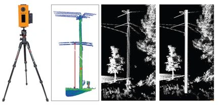
ROPOLI - PORTABLE LiDAR
Ropoli is a game-changer for pole inspections. This one-man, one-device portable LiDAR solution is designed for capturing hard-to-reach poles. Ropoli captures a dense point cloud in just 4-5 seconds, overlaid with a 12MP image including GPS and Digital Compass. The Data collected by Ropoli provides 1-inch level accuracy of pole heights, spans, attachments and guy wires.
The data collected is seamlessly uploaded to the cloud for pole-loading analysis, designing and drafting. Ropoli is fully adaptable to cityscapes, best used for sidewalks, back alleys, and rear lots.
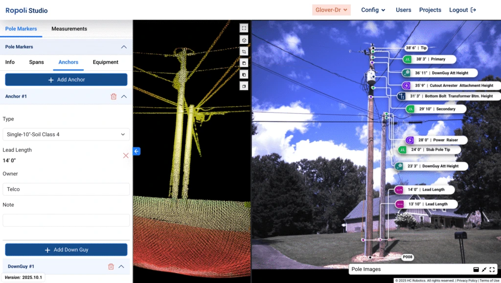
The Ropoli Portable LiDAR system is designed for seamless and efficient field data collection, offering a lightweight and user-friendly solution for professionals. With advanced features and high-resolution capabilities, it provides exceptional accuracy in mapping and asset management. Key highlights include: